![]()
![]()
![]()
Use LEFT and RIGHT arrow keys to navigate between flashcards;
Use UP and DOWN arrow keys to flip the card;
H to show hint;
A reads text to speech;
188 Cards in this Set
- Front
- Back
|
How do landscapes change through time? |
Through spatial and temporal evolution of the earths surface Spatial: location and height (space) - erosion, deposition, deformation Temporal: evolution over time |
|
|
What are fluvial landscapes |
Landscapes formed by running water. Water is delivered as rain or snow but this will melt. They dominate the earths surface |
|
|
What are landscapes formed by running water called |
Fluvial landscapes |
|
|
Conceptual methods: cycle of erosion |
WM davia developed the cycle of erosion- landscape evolution (19th century). This is an evolutionary approach borrowed from Darwinism. Davis model had key concepts. |
|
|
Key concepts of davis cycle of erosion (3) |
Potential energy Base level Peneplanation |
|
|
Davis cycle of erosion key concepts: potential energy |
The potential to do work through erosion. This is determined by the land surface height above a reference level. Newer landscapes with steep slopes have more surface for potential energy |
|
|
Cycle of erosion key concepts: base level |
The level to which the landscape erodes e.g. reference level. This is the equivalent to sea level |
|
|
Cycle of erosion key concepts: peneplanation |
The decline in surface elevation, gradient and relief over time as the landscape erodes |
|
|
What did Davis suggest about his model - cycle of erosion |
That there should be some sort of uplift event. The concept expressed that there was a mechanism that would uplift land - high altitude. Uplift brings valleys and mountains together. Older, mature landscapes are typically quite flat |
|
|
Modifications to Davis cycle of erosion model included (3) |
Renewed uplift Climate Geology |
|
|
Modifications to the cycle of erosion: renewed uplift |
Leads to landscape rejuvenation and creation of a polycyclic landscape (mix of young and old landforms). Leads to further steepening |
|
|
Modifications of the cycle of erosion: climate |
Landscape evolution depends on the intensity of geomorphic processes, which varies between humid, arid and glacial climates |
|
|
Modifications of the cycle of erosion: geology |
Lithology and structure influence the evolution of drainage patterns. Resistant material leads to positive relief compared to sedimentary areas that are lower and more eroded |
|
|
Orogenic uplift |
Uplift by horizontal compression and folding of the earth crust. E.g. Himalayas (rate of 5-10mmyr-1). Crushing together of crust leads to thickening of the crust that's then pushed up |
|
|
Epeirogenic uplift |
Uplift by vertical elevation of large blocks of the earth crust e.g. Colorado plateau (rate of 0.1mmyr-1). Due to slower tectonic processes. Causes are likely to be cooling or heating of the underlying mantle. Mantle under Africa is quite hot so it floats up. Level beds as there's no cracking or distortion. Rates are slow |
|
|
Isostatic response to erosion (6) |
•80-85% height lost to erosion is regained by isostatic adjustment of the crust •surface uplift = rock mass uplift - exhumation •mountains are high because material has been crushed together but is light than the underlying mantle rock. Mantle rock is denser allowing the overlying rock to stay up •oceans are low cos floor is made of heavier rock (basalt). It's denser than continental rock so it doesn't take as much to make the same weight •when landscape erodes it's removing weight so mass floats up from underneath. |
|
|
Difference in width of continental crust and Oceanic |
Continental - can approach 100s kilometres Oceanic- 5-10kilometers |
|
|
What did deglaciation do |
Unweighted the landscape so it started to rise. Material is very viscous so it's much denser. It responds but takes a while -readjustment |
|
|
Mechanisms of denudation: weathering (4) |
Physical (frost thawing alternation) - rapid in areas where ice is thawing Chemical (dissolution of CaCo3) - physical and biological processes Biological (roots) All are temp and moisture dependent (plant growth, presence of ice vs water) |
|
|
Mechanisms of denudation: erosion and transport (4) |
Water Mass movement- failures of weaker rock and soil due to steep slope Glaciers Wind |
|
|
The load of a river is |
The total amount of material transported by a river |
|
|
3 components of river load |
Dissolved load (carried in solution 20%) Suspended load (sand, silt, clay 70%) Bedload (sand and gravel 10%) |
|
|
Eroded sediments will be deposited at (4) |
1. Foot slope positions before reaching rivers (colluvium) - common in regions that were previously glaciated u shaped valleys 2. In river flood plain: alluvium 3. Intertidal zones building up estuaries or deltas e.g. Nile 4. Reach open sea, building up fans at sea/ocean basin floor - Bengal fan |
|
|
Controls on denudation rates (5) |
•basin relief •climate and vegetation- low erosion rates in areas of little rain. More vegetation in areas of high rainfall •lithology, tectonics and storm frequency •river incision rate - controls river relief. As mean local relief increases, erosion increases •glaciers- deepen valleys and may promote uplift. Isostatic uplift response due to removal of mass |
|
|
Eustatic controls on denudation rates |
Sea water and ice volumes, thermal expansion of water |
|
|
Isostatic adjustments on deundation rates |
Due to surface loading and unloading |
|
|
Tectonic controls on denudation rates |
On ocean basin volume |
|
|
Landscapes evolution involves the balance between |
Processes of uplift and denudation |
|
|
Isostatic compensation is a key control on |
Global topography, mountain height and net denudation |
|
|
Denudation |
The processes that cause the wearing away of the earth surface by moving water, by ice, by wind and by wave, leading to a reduction in elevation and in relief of landforms and landscapes |
|
|
Mass conservation concept |
General concept is that mass can't be created nor destroyed - only exception is radioactivity which doesn't apply to physical geography. Basic concept is that you have sediment coming in. Most change upwards in land surface if you have land upward and material being deposited. Balance between uplifting forces bringing land up and erosion forces bringing land down |
|
|
Change in land surface elevation = |
Amount of uplift or subsidence + balance between sediment supply and removal |
|
|
Equation measurements (4) |
M3 = measurement of volume M2 = measurement of area Qs = discharge of sediment Q= discharge of something |
|
|
Landscape is defined as |
Equilibrium when they experience no net change in form. This occurs when sediment input - sediment output + uplift = 0 |
|
|
Why is equilibrium important |
To identify an equilibrium, one must specify the time and space scale of interest - it is a scale dependent concept. It's important as we need to understand if landscapes as in a steady, static condition or in the middle of changing conditions. |
|
|
Change in landscape is to do with |
Frequency and magnitude of events that shape the landscape |
|
|
Process-form feedbacks |
Form is the shape. Water has to flow down channels - effects where sediment is transported, how quickly, how deeply and where it's left = erosional and depositional processes. |
|
|
Equation for power |
Water discharge x slope = power (sediment transport law determined empirically) |
|
|
What do power laws do |
Power laws plot straight lines on graphs that have logarithmic axes. Graphs without logarithmic axes, the power laws appear as curves |
|
|
Diffusive processes |
Something moves in response to only a surface gradient (steeper location, the faster stuff moves like landslides and soil creep) |
|
|
Advective processes |
Includes slope term and discharge. Sediment movement by water- driven processes |
|
|
Equilibrium landscape forms |
Driven by relationships that had transferred into laws. Negative feedback e.g. deposition of sediment reduces slopes which = more deposition. Positive feedbacks amplify initial disturbances whereas negative feedbacks dampen initial disturbances. Topographic landscape evolution lead to strong negative feedbacks |
|
|
Topography |
Defines drainage direction of the river systems |
|
|
Drainage basin |
An area of land that all drains in the same outlet |
|
|
Discharge |
The flow rate measured in m3s-1 (cubic meters per second) and is the amount of water that passes by time unit through a section of the river |
|
|
Area = |
Width x height |
|
|
Bankfull discharge |
The discharge that fills a stable alluvial channel up to the elevation of the active floodplain |
|
|
Alluvial channel |
A river formed by itself by it's own channel material and water flow |
|
|
Discharge = |
Width x height x velocity or area |
|
|
Velocity |
Measured in meters per second (ms-1) and is dependent on slope (s), depth (h) and roughness coefficient (C) |
|
|
River capture |
Leads to changes in basin drainage area, river discharge and sediment load. Drainage basin splitting is driven by uplift and denudation. |
|
|
Steady state river |
Has a constant uplift rate and rainfall rate. Rivers are one of the more stable features on a continent |
|
|
What are drainage basins set by |
The interaction of fluvial processes of erosion and deposition. Geological processes also play out over deep geological time. Erosion rates are low in flat landscapes. |
|
|
The hydrological cycle controls |
Production of runoff and the erosion, transport and deposition of sediment |
|
|
What are the water flows in drainage basin |
Precipitation, interception, transpiration, overland flow, infiltration. Erosion of soils is usually due to surface runoff |
|
|
Sediment transport: erosion and deposition |
The ability of water to erode and transport sediment particles depends on the competence of the flow and sediment size. Sand is around 2mm in diameter. It takes a higher velocity to move gravel. Finer material is harder to move because it's usually sticky- individual clay particles stick together. |
|
|
Sediment transport: transport capacity |
The measure of the total amount of sediment it can carry. It's calculated as a function of shear stress exerted by the fluid and critical shear stress instead of velocity |
|
|
Sediment transport: sediment delivery ratio |
The fraction of sediment eroded from slopes that reaches the drainage basin outlet. It tends to decline downstream because sediment storage potential increases as valleys become wider and less steep. It's the ratio between sediment output from the basin and sediment eroded from slope. Higher delivery ratio when there's less sediment sinks |
|
|
Sediment delivery ratio = |
Sediment output from basin / sediment eroded from slope |
|
|
Source to sink concept |
That sediment moves from source to sink along a jerky conveyor belt. More erosion in steeper upward regions. Water needs gravitational slope to erode |
|
|
Small scale sediment stores |
Environments that used to be glaciated. Aeolian systems represent stores of sand that's migrating |
|
|
Large scale sediment stores |
A tectonic down working crust. Subsidence has occurred so topographically, the bedrock is many kilometres down with a high storage rate |
|
|
Total area of Bengal fan |
12.5million km3 (size of Amazon basin) - fans collect sedimentary material from systems |
|
|
Sediment accommodation space |
Space available to store sediment |
|
|
The amount of sediment stored depends on |
The equilibrium long profile shape of the land surface/river that transports the sediment |
|
|
Sediment is stored in 2 primary ways |
Sea level rise and tectonic uplift. Sediments as deposited during relative sea level rise. Tectonic uplift changes the slopes in the system. Sediment is transported out of eroded headwaters. Rivers will adjust their profiles, so they can transport the material that's coming into them otherwise they build up |
|
|
River long profile (4) |
•represents the change in height of the riverbed moving downstream from the headwaters to the sea •they adjust to transport the amount of water and sediment supplied from upstream •discharge increases downstream as drainage basin area increases - profiles are concave •adjust their transport of sediment to end up in a dynamic equilibrium |
|
|
Equation of the sediment transport theory |
Discharge of sediment x diameter of sediment goes as (linear function of) discharge of water x slope of river |
|
|
Degradational system |
When more sediment is being eroded and transported out |
|
|
Controls on the river long profile (3) |
•sediment load increases at a declining rate cos of increased sediment storage •the size of the sediment being transported tends to decline due to abrasion and changes in sediment sources and river competence •leads to changes in river gradient - if slope didn't decrease, all sediment would be flushed away. Rivers adjust so the lower regions tend to have lower slopes = long profiles |
|
|
River forms (5) |
•straight rivers are engineered •bedforms are pushing at the banks and trying to get the river to migrate •most rivers are meandering - move laterally due to sediment deposits •Rivers won't migrate if constrained between hard bedrock •braided rivers are found where there is a high sediment flow and is a function of discharge and slope |
|
|
Controls on channel pattern (2) |
Slope and discharge Bank strength |
|
|
Controls on channel pattern: slope and discharge |
Braided rivers tend to be steeper than meandering as this gives the flow more energy to carve banks. Helps us understand how a river moves from one form to another |
|
|
Controls on river patterns: bank strength |
Controls widening, limits lateral sediment supply and depends on bank material, sediment load and mechanism of floodplain construction. If banks are weak rivers can migrate into them easily. Aggradation of systems has to happen along a valley floor. When rivers flood they as slowly infilling their accommodation space |
|
|
Avulsive processes |
A way rivers infill their accommodation space |
|
|
What controls accommodation space |
Base level, tectonics and equilibrium landform morphology |
|
|
Eustatic controls on sea level change |
Include sea water and ice volumes, thermal expansion |
|
|
Isostatic adjustments are due to |
Surface loading and unloading |
|
|
What controls ocean basin volume |
Tectonic controls |
|
|
The coastal zone |
Extent corresponds to limits associated with changes in sea level of the quaternary. Level of oceans is significant because the periphery of continents is low gradient - caused by sea level change. |
|
|
What regions as caused by the denudation of the coastal zone (4) |
Continental slope Continental shelf Shoreface Coastal plain |
|
|
Water depth at the end of a continental shelf |
Usually 100-200m |
|
|
Key concepts: morphodynamics and sediment budgets on estuarine and deltaic coasts |
Coastal environments have significant morphodynamic feedbacks. Processes give rise to sediment transport which feeds back into the morphology. Estuarine coasts have a minor sediment budget, deltaic coasts have a higher budget |
|
|
Waves (4) |
•generated by wind and seismic activity •deep water wave height is determined by wind speed and duration •as waves approach the shore they are influenced by frictional drag of the sea bed •waves steepen before breaking - some energy is dissipated, providing energy to drive sediment transport processes |
|
|
Tides (3) |
•produced by the attraction of the sun and moon and are influenced by the shape and size of ocean basins and the coriolis force •spring tides are when the moon is aligned •neap tides happen at other times |
|
|
Tidal range (5) |
•controlled by bathymetry, width of continental shelf, coastal configuration and distance from zero tide amphidromic point •tidal range and coast gradient determine the extent of the intertidal zone •variations is set by the interplay of the earth and moon gravity •microtidal (2m or less), mesotidal (2-4m), macrotidal (4m +) •microtidal is wave dominated, macrotidal is tide dominated |
|
|
Controls on coastal erosion (5) |
•Wave environment (height, storm, event frequency) •coastal lithology (susceptibility to weathering and erosion, structure, availability of erosional tools) •morphology (platform configuration, cliff height and angle, bathymetry) •tidal action, climate, biological activity •higher energy systems with low sediment inputs and high tidal flushing |
|
|
Waves platforms |
Protect coastal areas due to stronger underlying bedrock |
|
|
Beach profile |
Sediment is moved and deposited in areas where it's not quickly flushed away. Shingle beaches are higher gradients than sand beaches. Beaches form on wave energy - higher flow velocities = bigger sediment size. Beaches adjust themselves in equilibriums |
|
|
Planform coastal features |
Deposits formed out of sand where waves are breaking |
|
|
Barrier islands |
Linear and parallel to land and separated by a lagoon. Low gradient coasts with low tidal range. Dependent on river discharges. Susceptible to erosion and and storm surges due to low tidal range. Provide resilience to lagoons |
|
|
Estuaries |
Valleys and lowland areas drowned by postglacial sea level rise. Usually a zone of salt and freshwater mixing. Sediment derived from local, fluvial and coastal sources. Deposition controlled by sediment size, water energy and salinity |
|
|
Salt marshes and mud flats |
Occur on upper parts of intertidal zones. Dissected by tidal creeks that supply/remove water and sediment. Salt tolerant vegetation trap sediment. Sensitive to changes in sea level and sediment supply |
|
|
Controls on sediment supply to coast (3) |
Catchment characteristics (size, relief, lithology, tectonics) Climate, soil, vegetation Human activity and engineering in catchment |
|
|
Controls on sediment dispersal at coast (6) |
River flow characteristics - flood frequency River sediment load - amount and size of sediment Strength of estuarine tidal currents Strength or absence of offshore currents Buoyancy or river water - determined by density contrast Wave environment at coast |
|
|
Delta types (3) |
Fluvial dominated Tide dominated e.g. ganges-brahmaputra in Bangladesh Wave dominated |
|
|
What causes changes in sediment delivery to the ocean |
Soil erosion and dam construction |
|
|
Impacts on deltas and mega-deltas by 2050 (7) |
Changing sediment input Precipitation change Sea level change Land and shelf subsidence Coastal erosion Subsurface abstraction oil, water, gas Increased population pressure (500 people per km2 on average) |
|
|
What human activities have changed sediment fluxes to oceans |
Dam construction Agriculture Deforestation |
|
|
Risks of living in coastal zone |
Up to half a billion will be living in the coastal zone at risk from flooding due to sea level rise, coastal subsidence, declining sediment supply from rivers and climate change |
|
|
What does vegetation affect (6) |
Hydrology Slope stability Soil quality Sediment trapping Atmospheric composition Surface roughness |
|
|
When does vegetation have a strong feedback (2) |
•when water flows into landscapes •into soil quality and helps the formation of clay and secondary minerals formed by the dissolution of bedrock |
|
|
Coastal dunes |
Sand movement is reduced with vegetation. It traps it resulting in an increased dune size. Input outweighs erosion due to coastal winds |
|
|
What defines a semi arid region |
25-50cm of precipitation per year |
|
|
Reasons for the global distribution of deserts and drylanss- controls on rainfall (4) |
Atmospheric circulation Continental isolation Rain shadow effects Ocean circulation |
|
|
Controls on rainfall affecting distribution of deserts and drylands: atmospheric circulation |
Large scale flow of air on earth that results in Hadley cells - sun energy hitting near the equator creating warm air that rises up. There is a mass of upwelling air near the equator. Once it reaches a higher zone in the atmosphere, it moves sideways to north and south - sinks 30 degrees. On average air is coming down making it more stable so less chance of convective precipitation and thunderstorms |
|
|
Controls of rainfall on distribution of deserts and drylands: continental isolation |
Waters in the ocean and large lakes. The further from the ocean, the warmer things get |
|
|
Controls of rainfall on distribution of deserts and drylands: rain shadow effects |
If air is forced over higher topography, it will rain. Greater moisture curing capacity, yet there is no moisture leading to less chance of rain in lower topography areas considered arid like death valley |
|
|
Controls of rainfall on distribution of deserts and drylands: ocean circulation |
Sets where the water is coming from that could evaporate and cause rain. If water is sourced from the poles it will be cold. Cold water will not evaporate as readily as warm water, so it provides more water to the atmosphere meaning less chance of rain |
|
|
Aeolian sediment transport mechanisms (3) |
Suspension Saltation Creep |
|
|
Aeolian sediment transport mechanisms: suspension (3) |
Finest particles - clays Carried by turbulent eddies and over large distances Dominates water flow due to viscosity |
|
|
Aeolian sediment transport mechanisms: saltation (4) |
Coarser particles - sand Move in long, low hops - bouncing Pass momentum by grain impacts and dominates air flow Strong gradient between sand moving |
|
|
Aeolian sediment transport mechanisms: creep (2) |
•Larger particles slide along the surface •Transported water- water is stronger and more viscous because rock weight is displaced by water buoyancy |
|
|
Desert pavements/regs (6) |
•loose particles eroded from the surface •sediment sorting is by selective entrainment which produces a pavement •erosion is limited by surface coarsening •dry, not densely vegetated, finer sediments blown by wind •coarse material left behind, rest blown away •no longer a sediment source if area is dominated by heavier sediment |
|
|
Ventifacts (driekanters) (3) |
•Produced by abrasion (sand blasting) by wind •changing wind directions and ventifact orientation of multiple facets that meet at sharp ridges •erosional features of rocks that's stuck up |
|
|
Yardangs (3) |
•wind abraided ridges orientated with prevailing winds and separated by abraded chutes that conduct wind blown sand •larger versions of rock left behind •not much vegetation |
|
|
Inselbergs |
Isolated mountains of resistant rock. Rounded slowly by abrasion over long periods. Found in central australia |
|
|
Sand seas/ergs (5) |
•large regions of sand deposition, induced by changes in wind speed (due to barriers or transitions between climate zones) •finer material moves in direction of prevailing wind •regions where more sand is arriving than is blowing out •transport rates and location induced by winds and velocity •regional transitions between climate zones affect these areas |
|
|
3 controls of dune formation |
Sand supply Wind regime Vegetation |
|
|
4 types of sand dune |
Barchans/crescentic dunes Transverse dunes Parabolic dunes Longitudinal (seif) |
|
|
Type of sand dune: barchans/crescentic |
Solitary, crescent shaped whose horns point downwind. Form where sand supply is limited, and wind is strong and constant. Dunes are isolated from each other |
|
|
Type of sand dune: transverse dune |
Form in sand rich environments with strong, steady prevailing winds. Barchans merge to form wavy perpendicular to the wind. More sand is needed. Barchans dunes competing so merge to form these ridges. There's a continuum, so more than 1 dune |
|
|
Type of sand dune: parabolic |
Crescent shaped with tips pointing upwind. Common in coastal areas with moderated abundant sand and winds and some vegetation. Depending on wind strength and impacts, parts of vegetation become more mobile. Lower portions of dunes become armoured with vegetation. Higher part of dune will continue to move in direction. Vegetation causes shape of dune to invert |
|
|
Type of sand dune: longitudinal (seif) |
Long straight ridges that are fairly parallel to the wind. Moderate to low sand supply and strong prevailing wind with minor variations in direction. Wind angle adjusts on a regular basis, so they are constantly reforming in directions |
|
|
Impacts of agrciulture (5) |
Loss of vegetation Increased runoff and erosion Soil organic matter decline Soil compaction Downward spiral in soil quality and fertility |
|
|
Loess plateau in China (3) |
•steep fertile landscapes that high erosion •solution to build terrace systems to slow erosion •a lot of effort to maintain and will collapse quickly when not maintained |
|
|
Consequences of deforestation (6) |
Soil erosion Slope instability Loss of soil productivity Increased river sediment load Destruction of coral reefs Climate impacts - loss of carbon storage |
|
|
Effect of vegetation on rivers (4) |
•influences external (water and sediment supply) •influences internal by forming feedbacks (bank strength, roughness, sediment transport, island development and floodplain formation) that control river form and functioning •roughness to landscape that slows water = feedback between form of sediment transport and deposition leading to flood plains •force water into single channel |
|
|
Ephemeral rivers |
Flashy regimes with high rates of sediment transport due to floods. Unarmoured riverbed. As shear stress increases, sediment transport increases. More flashy flow regimes, deviate from normal river regimes seeing more sediment moved at one time |
|
|
Arroyos |
Deep channels found in semi-arid environments where formation is driven by land use and climate change. Common occurrence of intense storms and positive feedbacks |
|
|
Mechanisms driving channel adjustment (3) |
1. Vegetation colonises bars that are dry at high flow 2. Vegetation prevents significant floodplain flow - sediment stays in floodplain 3. Vegetation slows bank erosion and prevents bend cut off |
|
|
What do the mechanism drving channel adjustment do |
Reduce channel width and force thalweg regions (pools) to link up to form an overall channel. In an abiotic world, soils would be shallow or absent, hillslopes would be rocky, rivers would be steeper and barely meander - no forced channelization and formation of single channels rather than braided. Would be chemical weathering |
|
|
What's on mars |
Crescent dunes due to lack of wind and vegetation. Topographic signature of life is not yet detectable |
|
|
Lack of vegetation is caused by (3) |
Atmospheric and ocean circulation Topography Continentiality |
|
|
What was the explanation of landforms in the beginning (late 17th century?) |
That landforms were created through mega floods. They were unaware of uplift and didn't have an understanding of tectonics |
|
|
What did James Hutton introduce (1726-97) |
Uniformitarianism and gradualism. He explained the features of the earths crust by means of natural processes over geologic time |
|
|
What did Charles Lyell (1797-1875) introduce |
Was at the centre of the development of geology and influenced Darwin. The notion of things happening slowly over time laid the foundation for Darwin's theory of evolution |
|
|
Unifortarianism |
'The present is the key to the past' - things happen slowly and momentarily. Processes that operated in the past were the same as those that operate today |
|
|
Gradualism |
'The earth has evolved slowly over a long period of time'. The landscape is a product of slow processes operating over a long time, as opposed to single, rapid catastrophic events |
|
|
Catastrophism |
Many landforms are a product of extreme events |
|
|
What events dominate landscape evolution- small and frequent or rare but extreme |
The most important events are those that do the most geomorphic work. A measure of geomorphic work is the total amount of sediment eroded or amount transported by a river during a year |
|
|
Equation for landslide sediment flux |
Magnitude x frequency |
|
|
What do small and large landslides have equal contributions to |
Total sediment flux because the landslide sediment flux is magnitude x frequency |
|
|
What does remote sensing allow us to do |
Look at distributions of landslides following events and work out how big they are and how frequently they occur in some areas |
|
|
Threshold discharge |
Discharge needed to transport sediments |
|
|
Does bedload move if a certain threshold has not been exceedd |
No |
|
|
Equation for dominant discharge |
Size of transport x frequency |
|
|
Equation for stream power |
Amount of water flowing x slope |
|
|
What are glacial erratics |
Large boulders that rafted on glaciers and were deposited by the glacial outburst flooding - rocktype doesn't match lithology so it's been transported far |
|
|
How is river competence calculated |
Based on dimensions of river channel and sediment characteristics |
|
|
Estimating velocity |
Based on roughness and diameter of largest particles |
|
|
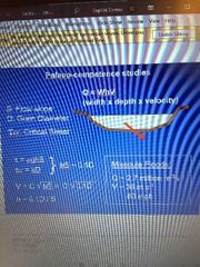
Palaeo-competence studies |
|
|
|
What does ice sheet extension alter |
Continental drainage pattern |
|
|
What was the result of the mount st Helens eruption (1980) |
Many hillsides were stripped of forest and as a result erosion has increased. The north fork toutle river is laden with sediment |
|
|
Slopes and shear stress |
At the beginning, shear stress is high because slopes are steep. It decreases when channels relax their slopes. It selectively moves fine material, leaving behind coarse material |
|
|
What is critical shear stress |
Shear stress needed go move sediment |
|
|
Channel responses after the mount st Helens erupton |
Initial aggradation Subsequent incision and widening Bed armouring |
|
|
What's the difference between a stable equilibrium system and a perpetually disturbed system |
Stable equilibrium is one where the river stays in one steady state. A perpetually disturbed is when the system is frequently affected by flood events |
|
|
What events dominate landscape evolution |
Those that have a long term impact on landscape form and functioning |
|
|
What happens during an active uplift of mountains |
When a river transports less sediments than supplied by landslides |
|
|
When does an upper fan surface form |
When the river has a higher transport capacity. As the supply declines, fan entrenchment occurs as river transport capacity declines |
|
|
Climate controls landscape evolution through (2) |
Land surface temp + rainfall affects processes and rates Sea level affects energy and for of rivers, deltas and shelves |
|
|
Climate system feedbacks (6) |
Ice albedo, periglacial processes - higher reflectance f solar waves Carbon cycle - warmer means more vegetation so more co2 captured by plants Thermohaline circulation - transporting heath to polar regions Sea level changes Precipitation and temp changes Vegetation changes - feedbacks |
|
|
Ice sheet melting naturally has given us how many m of sea level rise |
10m |
|
|
Post glacial rebound |
•ice melts so the ice sheet gets lighter making the lithosphere bounce back - isostatic rebound •bedrock is eroded away •the asthenosphere is moving under the crust which is pushing Scotland up, making England fall •large continents are coming up because the oceans are coming down |
|
|
What does vegetation change drive |
Changes in the hydro cycles Rates of surface erosion Global distribution of landforms |
|
|
Landscape evolution |
Short term deviations from progressive landscape lowering |
|
|
When is the thermohaline circulation weaker |
During glacial periods and more active during interglacial. During glacial periods, less energy is transported so there are bigger temp differences |
|
|
What do kniks indicate and who suggested this |
Schumm interpreted Davis' cycle of erosion Indicates different periods of erosion, steady state and deposition |
|
|
River terraces |
formed by alternating periods of erosion and deposition |
|
|
What happens to a river terrace during aggradation/deposition |
Valley floor is filled with sediment |
|
|
What happens to the river terrace during degradation/erosion |
Incise of the river in these deposited sediments - sediments are removed. The second phase of degradation leads to a second terrace and so on |
|
|
What do you need for a river to aggrade |
To increase sediment discharge or decrease water discharge leading to a steeper slope |
|
|
River long profile evolution (3) |
Long profiles are concave. •degradation increases, aggradation also increases as well but less fast than degradation •when aggradation/degradation decreases, distance also decreases |
|
|
Glacial cycles and long profile change (4) |
• during glacial, upland glaciers supply abundant coarse material to periglacial braided rivers •sediment enters storage in braid plain deposits and is remobilised during interglacial •remobilisation involves the cutting of a trench - it's deposited downstream as a fan •post glaciation sediment piles up at the bottom of the slope - this delglaciation involves the carving of the trencn |
|
What is this |
Braid plain with alluvial terraces |
|
|
What are fluvial knickpoints |
Drops in the cliff created by sudden short uplift periods |
|
|
Incision of river and creating of knickpoint |
•locally increased erosion potential due to increased steam power (runoff), bedrock differences •creating a difference in height - difference increases locally the slope •more stream power and erosional potential •difference in height is bigger •backward erosion of knickpoint - positive feedback |
|
|
Do landscapes and sediment deposits provide a reliable archive of environmental change |
Deposits provide a record of past environmental conditions. Must understand relationships between environmental change and landscape response to make use of deposits |
|
|
Causes of fan entrenchment (3) |
1. Paraglacial decline in sediment supply - from aggrading to degrading 2. Product of difference between slope and river sediment transport regimes 3. Process - form feedbacks |
|
|
Equifinality |
When different processes or environmental conditions can produce the same landform |
|
|
What are polygenetic dams composed of |
Mainly glacial and landslide debris occurring in fully deglaciated headwaters |
|
|
What risks will future climate change increase (4) |
Soil erosion due to runoff Flooding risks Riverbank erosion risks Coastal erosion risks |
|
|
Floodplain are highly productive (3) |
•agriculturslly - in Japan people don't live in the mountains because of natural hazards and land is unproductive so they live on coastal plains •the Mekong has 10m+ people living on it •sediment is important and needed for a river to reconstruct itself |
|
|
What regulates sediment transport |
Discharge and shear stress |
|
|
Future changes in hydrology in Europe (3) |
Increased flood risk Change in timing of snowmelt floods Enhanced soil erosion potential in northern and southern europe |
|
|
What do climate cycles affect |
Ice volume Sea level Isostatic response Local precipitation and vegetation |
|
|
What do glacial cycles and eustatic and isostatic responses impact |
Sea level Coastline position Coastal landforms |