![]()
![]()
![]()
Use LEFT and RIGHT arrow keys to navigate between flashcards;
Use UP and DOWN arrow keys to flip the card;
H to show hint;
A reads text to speech;
37 Cards in this Set
- Front
- Back
|
What is the name of the north-to-south road that runs through the middle of Roman-planned cities? |
cardo |
|
|
What is the name of the east-to-west road that runs through the middle of Roman-planned cities? |
decumānus |
|
|
Where did the Romans almost always place their forums within a city? |
At the intersection of the cardo and decumānus streets. |
|
|
Which road was the primary "main street" of Rome, unless circumstances prevented it? |
the cardo |
|
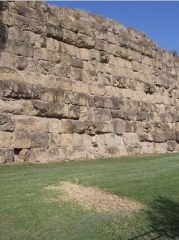
What is this type of masonry called? Describe it. |
Polygonal masonry is characteristic of Roman roads and walls, especially in the region of Latium, which is the central-western Italian region that includes Rome. |
|
|
Where was Dacia? |
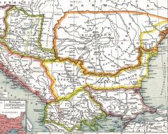
Modern-day Romania/Moldavia |
|
|
Where was Thracia |
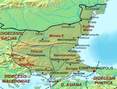
Modern-day Bulgaria, including the portion of Turkey that descends southwest to Constantinople. |
|
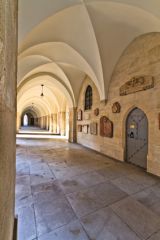
What is this type of ceiling called? |
a groin vault ceiling |
|
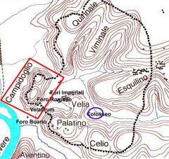
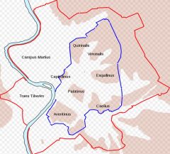
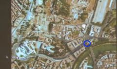
Where is the Palatine Hill in this picture? |
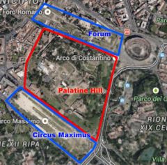
|
|
Where is the Aventine Hill in this picture? |
|
|
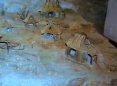
In what century did Romulus settle Rome? |
8th century B.C. |
|

What is this a depiction of?
When was it built and by whom? |
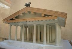
The Temple of Jupiter OMC Aedes Iovis Optimi Maximi Capitolini
First built by the Etruscans in 6th c. BC |
|
|
Regarding the original Aedes Iovis Optimi Maximi Capitolini,
What were its columns made from?
What were its pediment and walls made from?
What were it's sculptural embellishments made from? |
Wooden Columns
Mud brick walls and pediment
Terracotta sculptural embellishments |
|
|
The Parthenon dates from what time?
What was it made from?
|
5th c. BC
Marble |
|
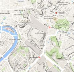
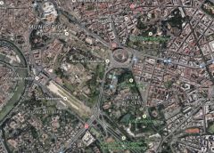
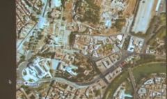
Where on this map is the Capitoline Hill?
|
|
|
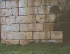
What do you call this kind of masonry?
|
ashlar masonry |
|
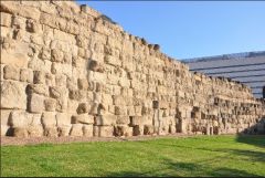
When and why was the Servian Wall built?
|
It was built after the Gauls sacked Rome in the 4th c. BC
|
|
|
What is the type of rock made from volcanic ash that was common around Italy and used for many building projects |
tufa |
|
Where is the Temple of Portuna |
It is here |
|
|
Greek vs. Roman Temples
Contrast the pediment style |
Greek pediments had stairs all the way around, but Romans had a 'facade-oriented' approach, having only stairs in the front with a much taller pediment. |
|
|
Greek vs. Roman Temples
Contrast the porch style |
Typically, Roman temples had deep porches, Greek ones did not. |
|
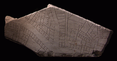
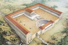
What is this a piece of?
|
The Forma Urbis
The Forma Urbis Romae or Severan Marble Plan is a massive marble map of ancient Rome, created under the emperor Septimius Severus between 203 and 211. It originally measured 18 m (60 ft) wide by 13 m (45 ft) high and was carved into 150 marble slabs mounted on an interior wall of the Temple of Peace. Created at a scale of approximately 1 to 240, the map was detailed enough to show the floor plans of nearly every temple, bath, and insula in the central Roman city. The boundaries of the plan were decided based on the available space on the marble, instead of by geographical or political borders as modern maps usually are. |
|
|
What is opus incertum? |
Opus incertum (irregular work) was an ancient Roman construction technique, using irregularly shaped and randomly placed uncut stones or fist-sized tuff blocks inserted in a core of Roman concrete (opus caementicium).
Used from the beginning of the 2nd century BC until the mid-1st century BC, it was later largely superseded by opus reticulatum. |
|
|
What is opus reticulatum? |
![Opus reticulatum (also known asreticulated work) is a form of brickwork used in ancient Roman architecture. It consists of diamond-shaped bricks oftuff, referred to as cubilia,[1] placed around a core of opus caementicium.[2]The diamond-sha...](https://images.cram.com/images/upload-flashcards/58/25/43/8582543_m.jpg)
Opus reticulatum (also known asreticulated work) is a form of brickwork used in ancient Roman architecture. It consists of diamond-shaped bricks oftuff, referred to as cubilia,[1] placed around a core of opus caementicium.[2]The diamond-shaped tufa blocks were placed with the pointed ends into thecement core at an angle of roughly 45 degrees, so the square bases formed a diagonal pattern, and the pattern of mortar lines resembled a net.Reticulatum is the Latin term for net-like, and opus, the term for a work of art, so the term translates to "net work". |
|
|
Where is Illyricum? |
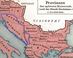
Illyricum was a Roman province that existed between 167 BC and 10 AD, named after conquered Illyria, stretching from the Drin river (in modern north Albania) to Istria (Croatia) in the west and to the Sava river (Bosnia and Herzegovina) in the north. Salona (near modern Split in Croatia) functioned as its capital. The province was then divided into Pannonia in the north and Dalmatia in the south. |
|
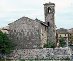
What is this a picture of?
|
The Temple of Hercules at Tivoli |
|
|
What is the latin word for the seating area of a theater? |
cavea |
|

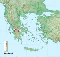
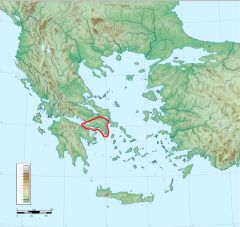
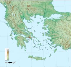
Where is the region of Achea on this map? |
|
|

Where is the region of Boetia on this map? |

|
|

Where is the region of Attica on this map? |
|
|

Where is Delphi on this map? |

|
|

Where is Sparta on this map? |

|
|

Where is Thebes on this map? |

|
|

Where is Rhodes on this map? |

|
|

Where is Crete on this map? |

|
|

Where is Corinth on this map? |

|
|

Where is Athens on this map? |
|